






How Was Palm Jumeirah Built? 10 Facts About Dubai's Man-Made Island
- 1. Palm Jumeirah Is a Man-Made Island
- 2. Construction Began in 2001
- 3. The Island Was Designed to Resemble a Palm Tree
- 4. Marine Sand Created the Island's Landmass
- 5. Rainbowing and DGPS Helped Shape the Island
- 6. Vibro-Compaction Prepared the Reclaimed Sand for Development
- 7. An 11-Kilometre Crescent Breakwater Protects the Island
- 8. Palm Jumeirah Added a Substantial Amount of Coastline
- 9. The Island's Shape Is Most Obvious from Above
- 10. Palm Jumeirah Requires Ongoing Beach Maintenance
- 11. FAQ
Quick Answer: Palm Jumeirah was built through marine land reclamation, using sand dredged from the seabed to form its trunk and 17 fronds. Engineers used Differential Global Positioning System (DGPS) technology and surveying to guide sand placement, while an approximately 11-kilometre crescent-shaped breakwater helped protect the reclaimed land from waves. Vibro-compaction improved the sand foundation before major infrastructure and building work proceeded. Construction began in 2001, and NASA records the island's construction as completed in 2006.
Palm Jumeirah Is a Man-Made Island
Palm Jumeirah is an artificial island created through land reclamation. Rather than developing an existing natural island, engineers formed new land in the Persian Gulf off Dubai's coastline.
The project involved placing large quantities of marine sand within a carefully planned boundary. Rock structures were built around the island to help protect the reclaimed land from wave action.
The distinction matters because creating an island is not simply a matter of depositing enough material above sea level. The resulting land must also be shaped, stabilized and protected before it can support roads, buildings and other infrastructure.
Construction Began in 2001
Palm Jumeirah's construction involved several overlapping stages, from marine land reclamation and breakwater construction to ground improvement and infrastructure development. The following timeline distinguishes the main engineering milestones from the completion of the island's overall landform.
Construction Timeline: How Palm Jumeirah Took Shape
Year | Construction Milestone |
2001 | Marine land reclamation and breakwater construction began. |
2002 | By April, the first 550 metres of the breakwater had been completed, allowing land reclamation to begin in the protected area. |
2003 | Land reclamation and breakwater construction were completed during 2003, according to The View at The Palm. |
2004 | Vibro-compaction began in March to improve the reclaimed sand before major infrastructure and building work. |
2006 | NASA records the island's construction as completed. Residential, commercial and infrastructure development continued beyond this milestone. |
These dates refer to different stages of the project, not a single completion milestone. Completing the reclaimed land and protective breakwater did not mean that all roads, utilities, buildings and community facilities were finished.
The Island Was Designed to Resemble a Palm Tree
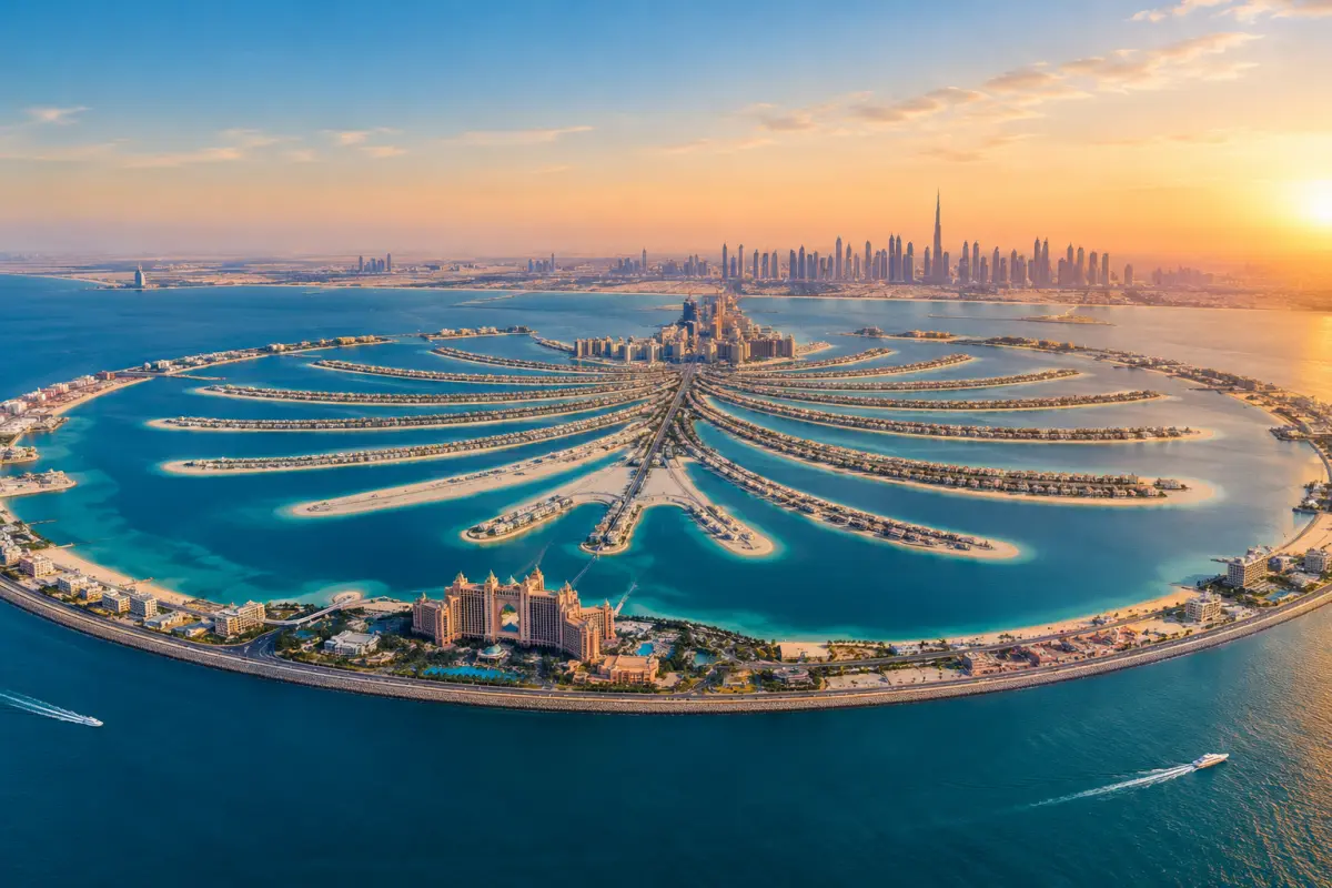
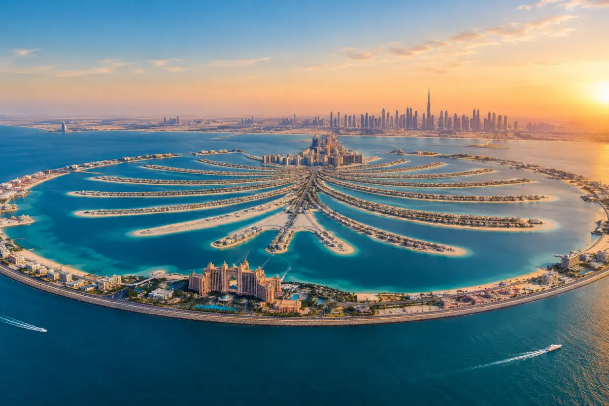
Palm Jumeirah's distinctive shape consists of three main elements: a central trunk, 17 fronds extending from the trunk, and a crescent-shaped breakwater surrounding the island's outer edge.
The layout was designed to create extensive waterfront development space within a relatively compact overall footprint. The fronds provide individual stretches of shoreline, while the trunk accommodates roads, residential developments, retail and other facilities.
According to Nakheel's Palm Jumeirah project information, the trunk is approximately two kilometres long, the island has 17 fronds, and the crescent extends for about 11 kilometres.
The recognizable palm outline is therefore both a visual design and a land-planning arrangement.
Marine Sand Created the Island's Landmass
Palm Jumeirah was built primarily using sand dredged from the seabed of the Persian Gulf. Specialist dredgers deposited the sand in designated areas to form the island's trunk and 17 fronds.
The choice of reclamation material depends on its engineering properties and the requirements of the project. For Palm Jumeirah, the selected marine sand was used in conjunction with ground-improvement techniques to prepare the reclaimed land for development. The suitability of sand depends on its grain characteristics and the demands of the project. Palm Jumeirah used marine sand, followed by ground improvement to prepare the reclaimed land for development.
TNASA reports that more than 50 million cubic metres of dredged sand were used to raise Palm Jumeirah above sea level.
Using marine sand allowed engineers to create the island's planned shape, but placing the material was only one stage of the construction process. Ground improvement and coastal protection were also necessary to prepare the reclaimed land for infrastructure and buildings.
Rainbowing and DGPS Helped Shape the Island
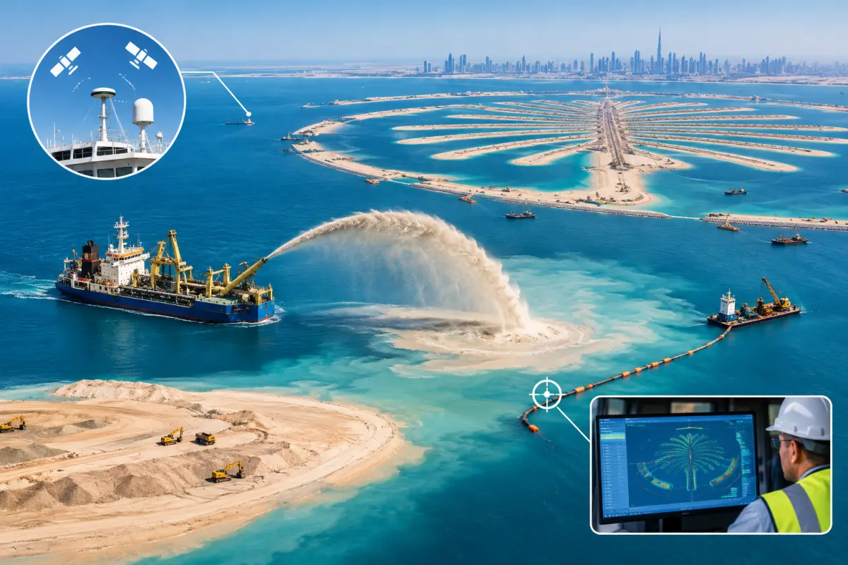
Creating Palm Jumeirah's trunk and 17 curved fronds required more than moving large quantities of sand. Engineers also needed to control where the material was deposited to match the island's planned outline.
One technique used was rainbowing, in which a dredger sprays a mixture of sand and water through a discharge pipe in an arc over the water. This allowed sand to be deposited in designated reclamation areas, including locations that vessels could not easily reach directly. Other methods, such as pumping dredged material through pipelines, were also used during the project.
To improve placement accuracy, the construction team used Differential Global Positioning System (DGPS) technology. According to The View at The Palm's engineering exhibition, positioning equipment and survey measurements helped guide dredgers and monitor the location and elevation of the deposited sand. Surveyors also checked the developing fronds against the planned layout.
Together, these techniques helped engineers form Palm Jumeirah's distinctive shape with greater precision. Rainbowing helped place the sand, while DGPS and surveying guided its position.
Vibro-Compaction Prepared the Reclaimed Sand for Development
Reclaimed sand may settle under its own weight or when roads, utilities and buildings add further loads. Ground improvement was therefore necessary to prepare Palm Jumeirah for development.
The project used vibro-compaction, a technique in which a vibrating probe is inserted into suitable granular soil to help rearrange and densify the sand. This reduces void spaces and improves the ground's engineering properties.
Ground improvement helps manage settlement, but it does not eliminate every settlement risk. Performance depends on local soil conditions, the loads imposed by construction and the engineering design. The treatment required for any specific area also depends on its ground conditions and intended use.
An 11-Kilometre Crescent Breakwater Protects the Island
Palm Jumeirah is surrounded by a crescent-shaped breakwater approximately 11 kilometres long. Built from rock, the structure reduces the island's exposure to wave action, including waves generated during storms and strong winds.
The breakwater was constructed using approximately 7 million tonnes of rock, including gabbro and limestone sourced from quarries in the UAE's Northern Emirates. Its layered design serves different engineering purposes:
- Core Layer: Smaller rock forms the main body of the structure and provides internal support
- Underlayer: Intermediate rock helps support the outer armour and distribute loads between layers
- Armour Layer: Large, carefully positioned stones, some weighing around 6 tonnes, resist wave forces and help protect the structure from erosion
- Geotextile: Water-permeable fabric separates construction materials and helps prevent finer particles from migrating between layers
The arrangement allows the breakwater to function as a protective barrier while accommodating the demands of a marine environment.
Water circulation was also considered in the breakwater's design. Two openings, each approximately 150 metres wide, allow water exchange between the waters inside the crescent and the open sea. Actual water renewal depends on tides, currents and local conditions.
The crescent breakwater illustrates an important principle of artificial-island construction: protecting reclaimed land requires more than building a strong barrier. Engineers must also consider how the structure interacts with waves, sediments and the surrounding marine environment.
Palm Jumeirah Added a Substantial Amount of Coastline
One of the major outcomes of land reclamation was the creation of additional waterfront land for residential and commercial development.
Palm Jumeirah's trunk, fronds and crescent provide a large amount of shoreline relative to the area enclosed by the island. This layout made it possible to develop waterfront properties, hotels and other facilities across different parts of the project.
According to The View at The Palm, Palm Jumeirah added approximately 70 kilometres of coastline to Dubai. This does not mean that every section is a public beach or freely accessible waterfront.
The Island's Shape Is Most Obvious from Above
Palm Jumeirah's palm-tree outline is easiest to recognize in satellite imagery and aerial views, where the trunk, 17 fronds and surrounding crescent can be seen together. From sea level, the view is more limited: visitors are more likely to notice sections of the shoreline, waterfront developments and crescent breakwater than the complete palm shape.
This difference highlights how viewing angle affects the way the artificial island is perceived. Aerial imagery reveals the overall master plan, while a view from the water offers a closer look at how the reclaimed land meets the sea.
Palm Jumeirah Requires Ongoing Beach Maintenance
Building Palm Jumeirah was only the first stage of creating a lasting coastal development. Waves and currents can gradually alter beaches, making periodic maintenance necessary.
Nakheel reported that the beach enhancement project, completed at the end of 2023, covered approximately 55 kilometres of beachfront and involved adding around 1.5 million cubic metres of marine sand. The figures describe this beach-maintenance project, rather than the island's original reclamation or its total coastline.
This highlights an important aspect of artificial-island development: reclaimed land and its beaches require ongoing management after construction. The extent of maintenance depends on local coastal conditions and how the shoreline changes over time.
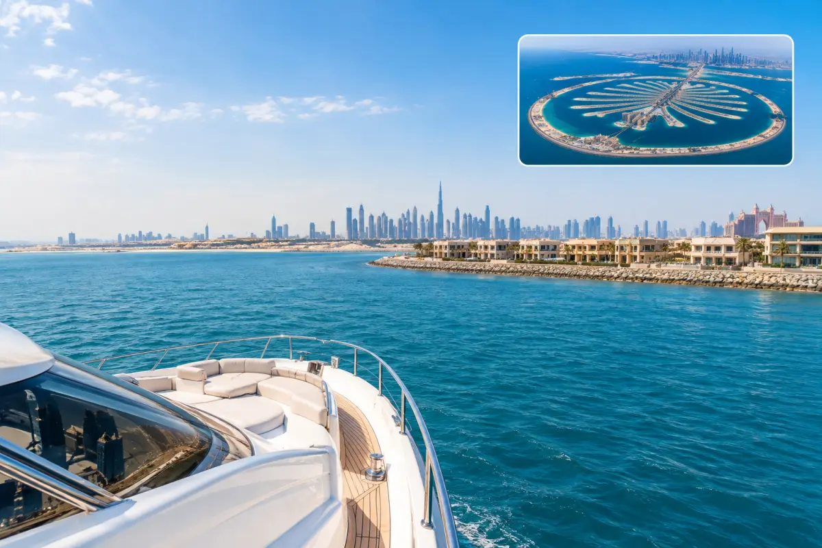
Seeing Palm Jumeirah From the Water
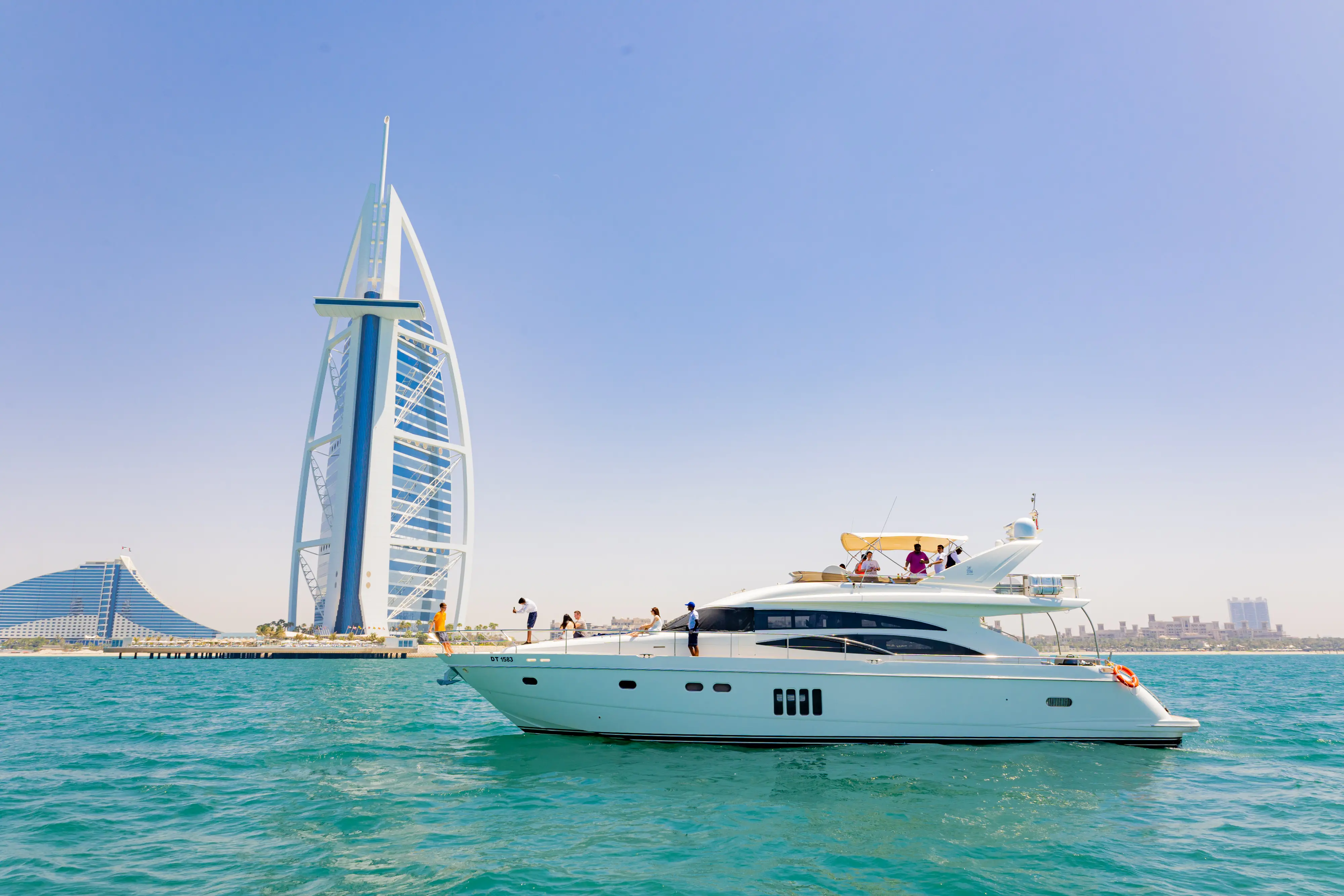
From the water, visitors can see sections of Palm Jumeirah's developed shoreline and crescent breakwater, although the full palm-tree shape is easier to recognize from above.
A yacht trip around Palm Jumeirah offers a closer perspective on how the reclaimed island meets the sea. Routes vary by departure point, itinerary, weather and operating conditions.
Explore Dubai Yacht Rental Options
About This Guide
This guide explains how Palm Jumeirah was constructed using marine sand reclamation, ground improvement and coastal protection works. Construction figures and timelines may vary between sources because they describe different project scopes or completion milestones. Refer to the cited project materials for the context of individual figures.
Sources
- NASA Earth Observatory — Artificial Archipelagos, Dubai, United Arab Emirates: Project timeline and dredged sand.
- Nakheel — The Palm Tower brochure (Palm Jumeirah overview): Trunk, fronds and crescent dimensions.
- The View at The Palm — Reclaiming the Land: Reclamation methods, material selection, DGPS positioning and construction sequencing.
- The View at The Palm — Breakwater Rocks and Stones: Breakwater design, rock layers and water exchange.
- The View at The Palm — Compacting Sand: Ground improvement and vibro-compaction.
- NASA Earth Observatory — World of Change: Urbanization of Dubai: Satellite imagery documenting the island's development.
- Nakheel — Nakheel marks the completion of Palm Jumeirah beach enhancement with contractors: Beach enhancement completed at the end of 2023, covering 55 kilometres of beachfront and adding 1.5 million cubic metres of marine sand.
FAQ
Can Palm Jumeirah Be Seen From Space?
Yes. Palm Jumeirah's distinctive palm-tree shape can be seen in satellite imagery. Its full outline is generally easier to recognize from above than from sea level.
Was Palm Jumeirah Built Using Desert Sand?
No. Palm Jumeirah was primarily formed using sand dredged from the seabed. The material was selected for the project's reclamation and engineering requirements.
Why Does Palm Jumeirah Have a Crescent-Shaped Breakwater?
The crescent-shaped breakwater helps protect the reclaimed island from wave action. Its openings also support water exchange between the waters inside and outside the crescent.
How Long Did It Take to Build Palm Jumeirah?
Construction began in 2001, and NASA records the island's construction as completed in 2006. Infrastructure and property development continued beyond that milestone.
Does Palm Jumeirah Have Natural Beaches?
Palm Jumeirah's beaches are part of an artificially reclaimed island, rather than the shoreline of a naturally formed island. Beach maintenance can include sand replenishment, and access varies by location.